
Freeze Thaw Weathering Diagram
Freeze Thaw Weathering Diagram It is important to be able to draw the Freeze Thaw Weathering Diagram. Use this video to help and to practice.
The 4 Types of Weathering
Four Types of Weathering The Four Types of Weathering Rocks are naturally weathered by atmospheric conditions. There are four main types of weathering: 1. Onion
Coastal Defences
How can we protect our coastline? https://www.youtube.com/watch?v=_rFH1ZFM40Y The Holbeck Hall was a famous hotel based on the cliffs near Scarborough. it is an excellent example
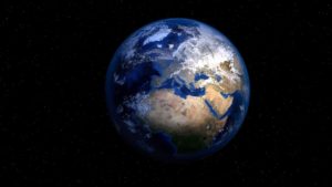
Plate Tectonics
Plate Tectonics Earthquakes and Volcanoes Call to Action The restless planet is continually moving and changing in response to the heat generated at the core
Japanese Earthquake 2011
Japenese Earthquake 2011 What Happened? March 11 2011 a cateogory 8.9 earthquake triggered off the SE coast of Japan. This event triggered a Tsunami that
Weathering
Year 6 Geography Weathering and Coasts Weathering Video
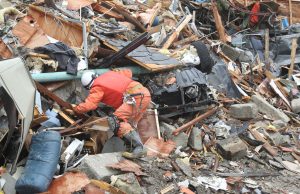
Reducing the Impacts of Earthquakes
Reducing the impacts of Earthquakes Learning Objectives Understand how buildings can be strengthened to protect from earthquakes Understand how early warning systems and education are
Coastal Features
What Physical features can we find along the Coastline? Learning Objectives Understand how erosion and deposition create features along the coastline Learn the names of
Headlands and Bays
Headlands and Bays Coasts How does the sea shape our coastline? Coasts – Headlands and Bays The sea is responsible for the formation of Headlands
Wave Cut Platform
How are Wave Cut Platforms Formed? Learning Objectives Understand what causes the formation of a Wave Cut Platform Learn how to draw the Wave Cut
Longshore Drift
How does the sea move material along the coast? Learning Objectives Understand how the sea moves material along a coastline Identify features that Longshore Drift
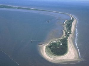
Formation of a Spit
How are Spits formed?? Learning Objectives Understand what causes the formation of a Spit Learn how to draw the Spit Diagram What are Spits? Submit
Tonga Volcano and Tsunami 2022
Tonga Volcano and Tsunami 2022 Where is Tonga? Tonga Development Capital City: Nuku’alofa Total area: 747.00 km2 (717.00 km2 land area, and 30.00 km2 water
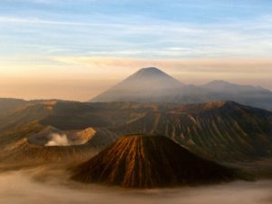
Volcanoes
Volcanoes Brought to you by Humf Teaches
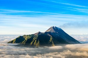
Mount Merapi
Mount Merapi Where is Mount Merapi? Indonesia Development Capital City: Jakarta Total area: 1,904,569 km2 Population: 2735000 (2020) GDP: $1.058 trillion GDP per capita is $3,869.59 (2020)
The Earth’s Crust
The Earth’s Crust Heat from the earths core Plate Boundaries The Earth is split into 7 major plates There are also 8 minor plates