

Map Run – A Great App that enables Virtual Racing and Navigation
This week I have started to use MaprunF. It is a running app that uses orienteering posts to direct runners around areas. You can choose a specific course that has been set up near you and you can either run around a predefined route, or collect the posts in any order within a time-specific frame.
Wendover Woods
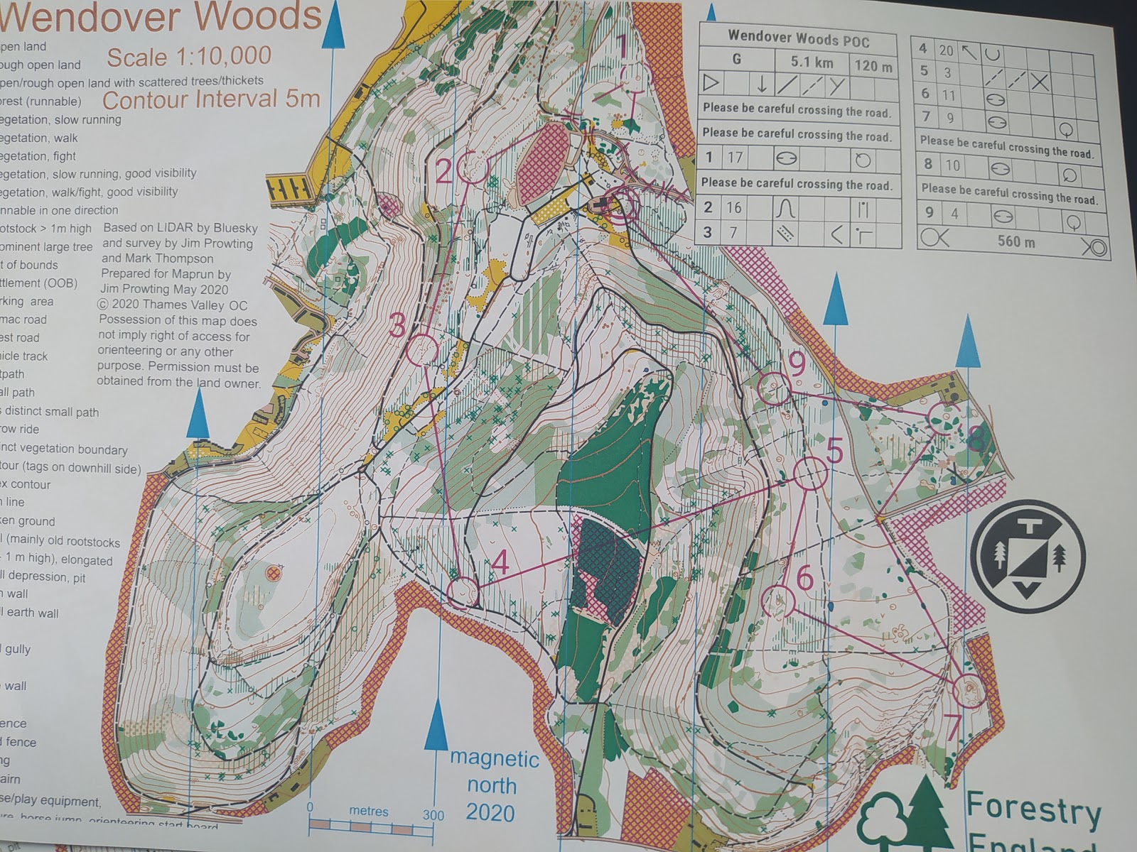
The app directed me to the start by potting my route on the map, and then once in the start area, the clock started, and the direction line disappeared.
The route was good, and it felt good again to be under pressure with time, which meant I pushed myself a little harder. In Wendover there were posts that you had to find, but the app generally knew you were there about 10m away from the post. In fact on the first post, I was surprised when my phone beeped to say I had punched the control post when I thought I was still a little further away.
Once I completed the round it totalled up my time and ranked me on the leaderboard. I was in 2nd, with about 10 other people having completed the course.
My time wasn’t great, and I am sure others will beat it, but it was a great first time on the app.
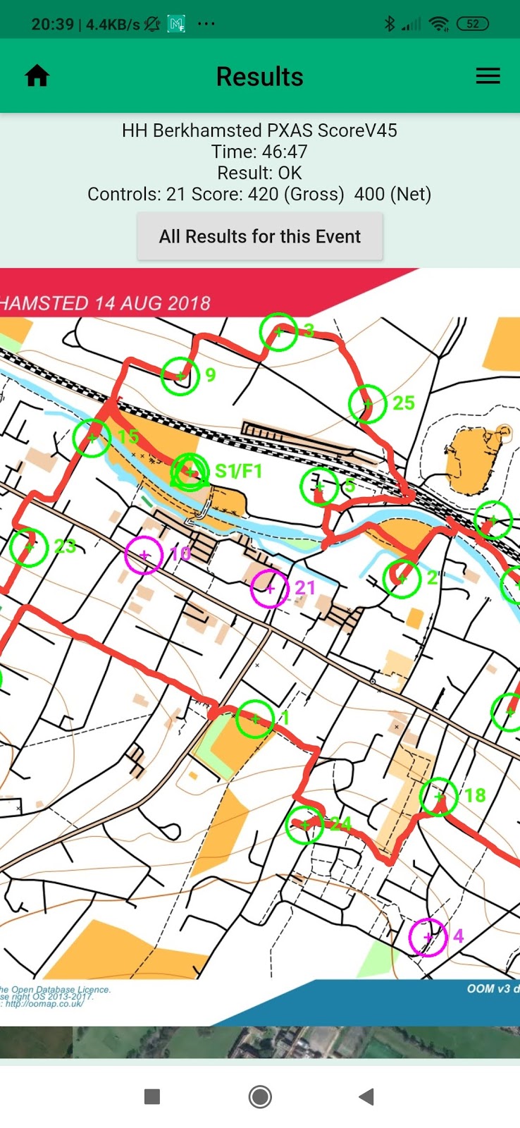
Berkhamsted Street
I managed to get about 17 of the posts but was late back by 2 minutes, which meant I suffered penalty points. I am much more comfortable navigating in the street than in the forest, so this was far more enjoyable for me than Wendover, and so I pushed myself further. many posts (20 in total) from around Berkhamsted. The difference between this and Wendover, is that there were no posts to find in Berkhamsted, and so you were solely relying on the GPS of the phone. I had no issues with the GPS and found it enabled me to run in a certain direction until my phone beeped at me.
  |
| View on MaprunF |
If you are looking for a really good app to get you competitively running again, it is worth looking at MaprunF.
[learn_press_profile]