How and where are waterfalls formed?
Task 1 – Google Earth Waterfalls

The tallest waterfall in Equadore has vanished .... and gone down a giant sinkhole #geography #geographyteacher #waterfall #sinkhole pic.twitter.com/Aypa64ocKn
— Geography made easy (@easygeography) September 26, 2020
Task 2 – Learn how Waterfalls are formed
Task 3 - Complete the Diagram on the Worksheet
Task 4 – Waterfall Diagram
This is a copy of the diagram you need to know how to draw at KS3, GCSE and Common entrance. Make sure you are explaining these key processes:
- Hard Rock is above the soft rock and erodes more slowly
- The Hard Rock overhang collapses
- Hydraulic Action and Abrasion form the Plunge Pool
- As the erosion continues the waterfall retreats, forming a gorge.

How do rivers transport material downstream?
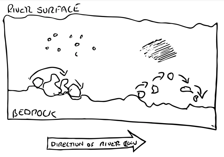
Rivers transport material upstream to downstream in 4 main ways:
- Traction – Where the load rolls along the bedrock.
- Saltation – The load bounces along the bedrock
- Suspension – The rocks are carried by the water
- Solution – The load dissoles into the water (like sugar in tea)
There is also a 5th way where load can be carried down on the surface of the rivers, called Flotation.
Why do bends develop in rivers?
River Meanders
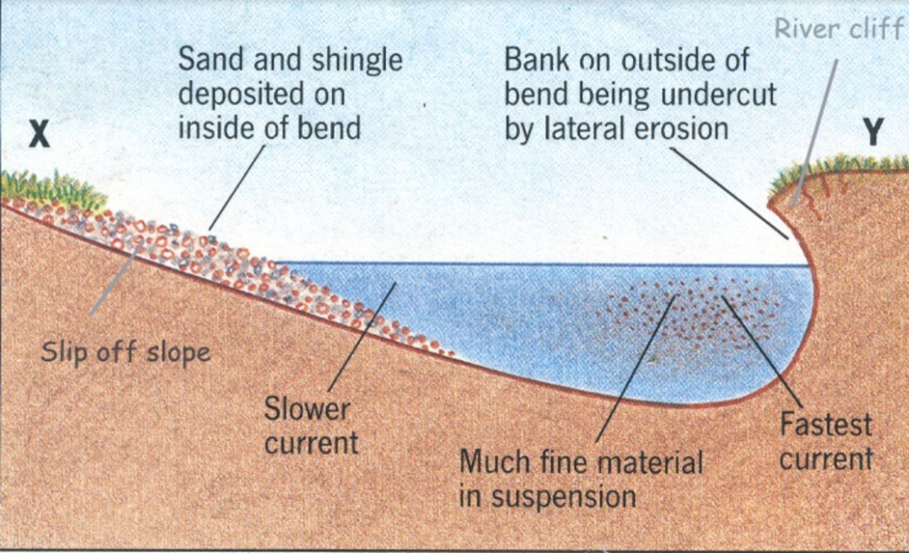
- Water flows fastest on the outside of the river bend.
- Water flows slowest on the inside of the river bend.
- Erosion happens on the outside of the bend.
- Deposition happens on the inside of the bend.
- The fastest line of the river is called the thalweg.
- As the erosion and deposition continues the meanders become more sinuous.
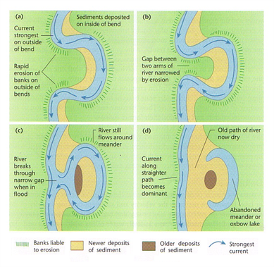
Ox-Bow Lakes
- Develop as the river becomes more Sinuous
- Eventually the bends will meet
- The river will take the fastest route and flow over the banks.
- Depostion will occur on the sides of the channel and the meander will become cut off.
- Eventually the lake will dry up and new land formed.
Watch an Ox-Bow lake develop in 4 minutes


I love this website. It helps me so much with my Geography prep!